East Lancashire CAMRA East Lancashire CAMRA
Supporting the Campaign for Real Ale in Blackburn, Burnley, Hyndburn, Pendle, Ribble Valley and Rossendale
Home
Latest News
CAMRA click to show or hide submenu
Branch click to show or hide submenu
Diary
Forum
Pub Guide click to show or hide submenu
Maps
Breweries click to show or hide submenu
Next Festival
Newsletter
Transport click to show or hide submenu
Links
Contact Us
CAMRA Website of the Year 2007
CAMRA Website of the Year 2010
Campaign for Real Ale
East Lancs Branch Map

The map below illustrates the geographical organisation of the East Lancs branch. The regions outlined in orange are actually council boundaries but they very closely resemble those of the six branch areas. Click any area to see a more detailed map of that region showing the locations of its main towns and villages.
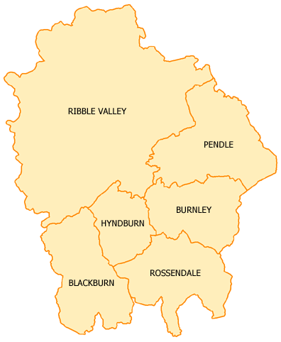
East Lancs CAMRA Map Ribble Valley Blackburn Hyndburn Rossendale Burnley Pendle

Find some Real Ale near You
Enter your full postcode and choose a radius to list real ale pubs in your area
     
Other East Lancs maps
Click on any of the links below to see other maps of the branch
Show the Blackburn Area Map
Show the Burnley Area Map
Show the Hyndburn Area Map
Show the Pendle Area Map
Show the Ribble Valley Area Map
Show the Rossendale Area Map
Real Ale Around Pendle
Discover some of the best places to enjoy Real Ale in Pendle
Want to know more? Click here!
XHTML 1.0 Compliant | Content © East Lancashire CAMRA 2006-17 Privacy & Disclaimer